|
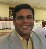
G.M. Tarekul Islam was born on 5 June, 1970 in Kotalipara of Gopalganj district in Bangladesh. He graduated in Civil Engineering from Bangladesh University of Engineering and Technology (BUET) in 1994 and completed his Master’s in 1996 from the same university. He joined the Institute of Water and Flood Management (IWFM) of BUET as a Lecturer in 1996. He was awarded Monbusho scholarship of the Government of Japan in 1997 for pursing PhD studies at the University of Tokyo, Japan. He completed PhD in 2000. In his PhD research, he explored three-dimensional flow fields in a doubly meandering compound channel under the supervision of Prof. Nobuyuki Tamai at the Department of Civil Engineering. After completing PhD, he returned home and joined the Institute again. He became Assistant Professor in 2000 and Associate Professor in 2005 and Professor in 2010. He was a recipient of JSPS fellowship for pursuing post doctoral research at the Department of Civil and Environmental Engineering of Hiroshima University, Japan.
Prof. Islam’s exposure to the fascinating field of geo-information science was when he took a course on GIS and Remote Sensing at the University of Tokyo. After returning home, he developed a course on Remote Sensing and GIS in Water Management for the post graduate students of IWFM. He took several advanced training on the subjects such as Geo-Informatics for Watershed Management in the Hindu Kush Himalayas at the International Institute of Geo-Information Science and Earth Observation (ITC), Netherlands during 23 August – 24 September, 2004; Geo-Informatics for Watershed Management in the Hindu Kush Himalayas at the International Centre for Integrated Mountain Development (ICIMOD), Nepal during 7 June – 2 July, 2004; Remote Sensing Education for Educators, Stockholm University, Sweden during 5 May – 13 June, 2003 and Application of Geo-Informatics for Water Resources Management at the International Centre for Integrated Mountain Development (ICIMOD), Nepal during 17 – 28 March, 2003. Currently he teaches Remote Sensing and GIS in Water Management at IWFM of BUET. Prof. Islam also teaches GIS and Remote Sensing Techniques in Disaster Management at the Institute of Disaster Management and Vulnerability Studies of Dhaka University. Prof. Islam supervised several post graduate thesis works involving geo-information science such as Development of Strategy for Delineating Drought Vulnerable Areas from Satellite Imagery; Application of Geoinformatics for Flood Study at Tarapur Union of Gaibandha; Application of Remote Sensing in Identifying Pollutant Spread in the Buriganga River and Analysis of Changing Scenario of Wetlands in Dhaka City Using Remote Sensing and GIS. Prof. Islam has published over 60 technical papers in national and international journals and conference proceedings.
Contact: tarekulislam87(at)gmail.com
|


